LANDSCAPE ARCHITECTURE

MEDSCAPES
The Landscape Character Assessment for Lesvos Island in Greece was prepared by a team of experts - Katerina Gkoltsiou was the Project Manager & Scientific Assistant- on behalf of the University of the Aegean as partner of the MEDSCAPES (ENPI CBC Mediterranean Sea Basin-2007-2013) research program.
The principal aim of the project is the development and implementation of an optimal methodology for the Assessment of Landscape Character (LCA), for the Eastern Mediterranean. In our case-study, the area of interest was the island of Lesvos, Greece.
The landscape character assessment process includes three stages: a) the desk study, b) the field work, and c) the classification of LDUs and amalgamation of landscape types. For purposes of amalgamation of our landscape types, the primary selection criteria were a) landform and b) land cover. Secondarily, c) settlement pattern and field patterns was also used to identify the final landscape types
The desk study was based on: 1) the review of relevant background reports, other qualitative and quantitative data and mapped information, 2) the application of this information in the creation of a series of map overlays of landscape factors for our area of interest, and 3) the first draft definition of LDUs. The field work aimed to: 1) gain an overall impression of the visual character of the landscape, 2) amend the boundaries of the mapped LDUs, as appropriate, 3) record (i.e. photograph) the landscape and its characteristic features, and 4) complete a field assessment sheet for each landscape unit, in situ. The classification of the LDUs and creation of landscape types included: 1) the adjustment/correction of LDUs and their cartographic presentation, if needed, 2) the creation and mapping of landscape types, and 3) the finalized description of the landscape types and their particular features.
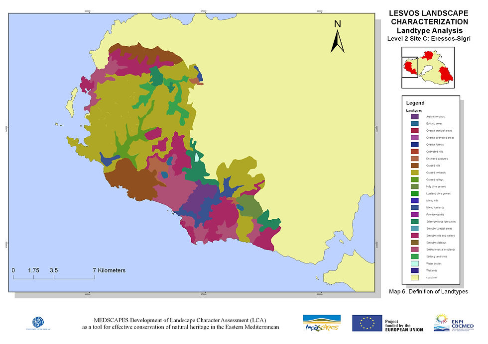
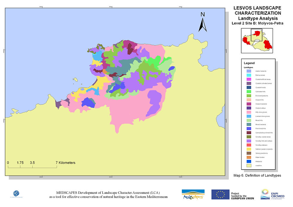
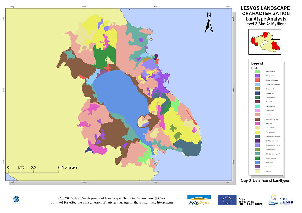
Based on field work validation, we concluded with 11 landscape types for Level 1 mapping (1:250.000) and 23 landscape types for level 2 (1:50.000) for 3 specific areas of Lesvos.
MEDSCAPES results may be incorporated in the Integrated Strategic Plan of the General Secretariat of Aegean and Island Policy. Τhe ultimate goals are to extent MEDSCAPES Level 2 mapping to the whole of the North Aegean Region, to implement the L.C.A. methodology in other regions of Greece and to apply L.C.A. methodology Level 1 mapping at a national level.
CATEGORY
Landscape Character Assessment
LOCATION
Lesvos
DATE
2014-2015